A river that shaped the city, and a city that must now restore the river Every major city has at least one overlooked piece of “hard-working nature” that quietly carries the burden of urban life. For Hyderabad, that burden has long rested on the Musi. The river is historic, culturally embedded, and geographically decisive, yet …
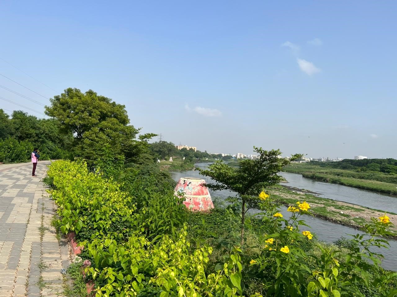

Table of Contents
- A river that shaped the city, and a city that must now restore the river
- Project snapshot
- Understanding the scale: riverfront development is not a linear park
- Why Musi needs an ecological approach first
- MRDCL’s planning posture: safeguards, buffers, and a long implementation runway
- VANZSCAPE’s stated role: competition coordination as a design responsibility
- The Nagole wetland: why a 5 km segment can carry city-scale value
- What “wetland design” usually entails in an urban river corridor
- Blue green infrastructure: the riverfront’s real design language
- The corridor ambition: connecting ORR West to ORR East
- Heritage, identity, and the “public face” of Musi
- Social inclusion: the hard part of “riverfront revitalization”
- Buffers and no-development zones: why they matter for design integrity
- Why wetlands are the most “honest” riverfront feature
- Implementation reality: DPRs, modeling, and long-term financing
- What professionals can take away from the Musi Riverfront scope
- Closing: Musi as Hyderabad’s next public commons
A river that shaped the city, and a city that must now restore the river
Every major city has at least one overlooked piece of “hard-working nature” that quietly carries the burden of urban life. For Hyderabad, that burden has long rested on the Musi. The river is historic, culturally embedded, and geographically decisive, yet it has also been treated as a drainage corridor for decades, absorbing sewage, solid waste, and encroachment pressures.
The Musi Riverfront effort is framed as a city-scale reversal of that pattern: shifting the river from “back-of-house infrastructure” to “front-of-house public realm,” and doing so through ecological systems rather than cosmetic beautification.
Within that larger mission, VANZSCAPE’s contribution is described in two direct, high-impact roles:
- Coordinating an international design competition to propose a comprehensive solution for the corridor.
- Designing a 5 km wetland at the Nagole stretch as part of the rejuvenation strategy.
This blog elaborates on what that scope implies, why wetlands matter in a riverfront project of this magnitude, and how blue green infrastructure becomes the real backbone of successful river restoration.
Project snapshot
- Program owner: Musi Riverfront Development Corporation Limited (MRDCL), Government of Telangana’s delivery vehicle for Musi corridor revitalization.
- Corridor ambition: transform a Musi stretch on the order of about 55 to 57.5 km into a revitalized riverfront system, depending on how the project boundary is defined in different public documents.
- VANZSCAPE’s stated involvement (2018–20): coordinated an international design competition for a comprehensive solution; designed a 5 km wetland at Nagole.
Understanding the scale: riverfront development is not a linear park
The term “riverfront” often gets reduced to a familiar checklist: promenade, lighting, railings, kiosks, and a photo-friendly edge. That is not sufficient for Musi, because the core challenge is systemic.
Public documentation around the Musi initiative frames it as corridor transformation, not a single site makeover. MRDCL describes its task as revitalizing the historic Musi and transforming the entire corridor into a vibrant hub for Hyderabad. Another official procurement document describes the project as transforming a stretch of Musi from ORR West to ORR East of about 57.5 km.
A corridor-scale riverfront typically requires five interlocking workstreams:
- Pollution interception and treatment, so the water body can recover.
- Flood and hydraulic management, so safety improves rather than degrades.
- Ecological restoration, so the river becomes a living system again.
- Public realm and access, so the river is experienced as civic space.
- Governance and maintenance, so outcomes persist beyond launch.
VANZSCAPE’s stated delivery of a wetland segment sits directly inside the ecological and water-quality workstream, where restoration becomes measurable and not just visual.
Why Musi needs an ecological approach first
For a polluted urban river, “cleaning” is not one action. It is a chain of actions, and the chain breaks if any link is missing.
Independent scientific work underscores how water quality can vary spatially along the Musi, with downstream stations showing severe pollution indicators in published assessments. This aligns with the lived reality of many urban rivers: as they collect flows from drains and nalas, their character shifts from seasonal river to perennial wastewater channel unless interception and treatment are handled at scale.
That is why wetlands are such a serious tool in river revival. They function as infrastructure that behaves like landscape, and as landscape that performs like infrastructure.
MRDCL’s planning posture: safeguards, buffers, and a long implementation runway
Large riverfront projects fail most often on two fronts: social friction and environmental under-specification. Recent public reporting indicates that financiers and experts are explicitly pushing safeguards and buffer logic into the Musi planning process.
A Times of India report in December 2025 notes the Asian Development Bank (ADB) awaiting detailed project reports, with emphasis on environmental and social safeguards, livelihood components, and related compliance review. Separate reporting describes government restrictions on development near Musi banks, with buffer zones and permission controls introduced to prevent unplanned construction while master planning is finalized.
For designers, this context matters because it shapes what “riverfront design” can ethically and operationally mean. A successful Musi riverfront is not only a design object. It is a negotiated civic transformation with long-term risk management.
VANZSCAPE’s stated role: competition coordination as a design responsibility
VANZSCAPE’s own project narrative notes that an international design competition was organized to propose a comprehensive solution, coordinated by the firm’s principal architect.
Competition coordination at this scale is not administrative. It is an architectural and urban design responsibility, because the coordinator influences:
- The framing of the problem statement, including what counts as “success.”
- The design standards and evaluation criteria, including ecology and social inclusion.
- The interfaces between engineering, planning, finance, and design.
- The realism of phasing, operations, and maintenance.
It is also consistent with MRDCL’s broader use of international competition and procurement to advance signature elements; MRDCL has publicly announced open international design competitions for iconic structures within the riverfront initiative.
In a river restoration program, the competition phase can be where ecology either becomes central, or becomes decorative. The stated scope suggests ecology was positioned as essential, not optional.
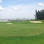
The Nagole wetland: why a 5 km segment can carry city-scale value
VANZSCAPE’s narrative specifically highlights designing the 5 km wetland at the Nagole stretch. That single line is important because wetlands are one of the few interventions that can simultaneously address:
- Water quality improvement
- Habitat creation
- Flood attenuation and flow moderation
- Public education and stewardship
- Microclimate cooling in dense urban conditions
Even if a wetland is only one segment of a 55 to 57.5 km corridor, it can operate as:
- A demonstrator, proving that a living water system is possible.
- A “treatment landscape,” reducing pollutant loads and improving downstream conditions.
- A biodiversity anchor, supporting birds, insects, and aquatic life.
- A public narrative space, helping citizens understand the river as a system.
In other words, a wetland is not a side feature. It is a strategic keystone.
What “wetland design” usually entails in an urban river corridor
A constructed or rehabilitated wetland is typically not a single pond. It is a sequence of zones, each doing a specific job. While the precise design details for the Nagole stretch are not publicly available through the project page in this environment, the ecological logic of successful riverfront wetlands is consistent across contexts.
A robust wetland system commonly includes:
1. Pre-treatment and sediment management
Urban flows often carry heavy sediment and floating debris. A pre-treatment zone helps settle solids and prevents the wetland from clogging prematurely.
2. Primary wetland cells for pollutant reduction
Vegetated wetland cells use plant roots, microbial communities, and slow water movement to reduce nutrients and improve water clarity over time.
3. Polishing zones and open water moments
To avoid creating a uniformly dense marsh, polishing zones and open-water areas are often introduced for habitat diversity and visual legibility.
4. Safe edge design
Urban wetlands must balance access and safety. That usually means carefully graded banks, controlled entry points, and edge planting that discourages unsafe shortcuts without “fencing off” the landscape.
5. Maintenance access and operational resilience
Wetlands fail when maintenance is treated as an afterthought. A practical wetland includes service paths, defined dredging or clean-out strategies, and planting palettes that tolerate seasonal variation.
If the Musi corridor is to restore “past glory” while remaining operationally manageable, wetlands like the Nagole stretch are the exact kind of infrastructure that can deliver measurable improvement without turning the river into a hard concrete canal.
Blue green infrastructure: the riverfront’s real design language
The most credible contemporary riverfronts are blue green systems, not beautified drains. In Hyderabad’s context, this is especially relevant because the city’s water challenges involve both scarcity and extreme weather risk.
MRDCL’s procurement documents show serious emphasis on hydraulics and modeling, which indicates the project is not being treated as mere landscaping. For example, MRDCL issued requests related to hydraulic simulation modeling and DPR preparation for retaining wall elements for parts of the system.
The design consequence is straightforward:
- A riverfront must handle flood events safely.
- It must also handle normal days beautifully.
- It must absorb uncertainty, not collapse under it.
Wetlands and restored floodplain landscapes are among the few tools that can do all three when correctly designed and maintained.
The corridor ambition: connecting ORR West to ORR East
Official documentation describes the Musi riverfront stretch as running from ORR West to ORR East, with a length on the order of about 57.5 km. MRDCL’s site frames the corridor scope as 55 km. Either way, this is not a neighborhood-scale intervention. It is metropolitan in scale.
At that scale, the riverfront becomes an organizing spine that can potentially link:
- Parks and public open spaces
- Pedestrian and cycling movement
- Heritage precincts and city identity anchors
- Environmental infrastructure like wetlands and treatment landscapes
- Mobility proposals that run parallel to or across the river
Public reporting has described proposals such as an east-west corridor along the Musi linking western and eastern parts of the city, along with bridges and public realm upgrades as part of the broader riverfront development.
Design teams working on such corridors must plan for coexistence, not competition, between ecology and infrastructure. That is where landscape-led thinking becomes decisive.
Heritage, identity, and the “public face” of Musi
A riverfront is not only environmental infrastructure. It is also identity infrastructure.
Hyderabad’s old city and newer expansions both read the Musi as a dividing line and a connector. A revived Musi corridor would likely become a place where:
- heritage bridges and edges are restored or reframed,
- cultural events can occur along civic promenades,
- everyday recreation becomes possible near water without health risk.
Even within the development ecosystem, iconic gateway elements and signature structures are being positioned as part of the project narrative through competition announcements.
The risk in heritage-led riverfronts is turning the river into a themed backdrop. The opportunity is using heritage as a wayfinding and storytelling layer on top of ecological performance. In Musi’s case, performance has to come first.
Social inclusion: the hard part of “riverfront revitalization”
When riverfronts get upgraded, land values move. That can create displacement pressure unless safeguards are designed in at the start. This is one reason financiers emphasize social compliance and livelihood components, as reported in December 2025.
For a project of this scale, inclusive riverfront outcomes usually require:
- Clear resettlement and rehabilitation frameworks where needed
- Livelihood planning for informal economies that currently depend on river-edge access
- Accessible public spaces that are not privatized by adjacent development
- Transparent phasing that avoids “half-finished” hazardous conditions
From a design standpoint, inclusion shows up in details:
- universal access paths,
- safe lighting and visibility,
- mixed-use edges that do not exclude low-income users,
- continuous connectivity rather than isolated “showcase” parks.
A wetland segment, when designed with public interpretation and safe access, can support stewardship rather than exclusion. It helps citizens feel the river is theirs again.
Buffers and no-development zones: why they matter for design integrity
Buffer zones are sometimes portrayed as restrictions. In river restoration, they are essential design space.
Recent policy reporting indicates buffer logic is being applied along Musi and Esa, including no-development zones up to 50 meters in certain regulatory framings and restrictions extending further while master planning is under review.
For riverfront design, buffers enable:
- floodplain room, reducing downstream peak impacts
- riparian planting and habitat creation
- continuous public movement corridors
- maintenance and emergency access without encroachment conflicts
In short, buffers are not leftover land. They are the operating envelope of a living riverfront.
Why wetlands are the most “honest” riverfront feature
Many riverfronts look successful at inauguration and decline within years. Wetlands, if correctly designed and maintained, are among the most durable elements because they are self-reinforcing systems.
They become more effective over time as:
- vegetation establishes,
- microbial communities stabilize,
- habitats mature,
- public familiarity grows.
They are also educational. A city that sees wetland water moving through planted zones begins to understand that clean water is produced, not purchased.
VANZSCAPE’s highlighted role in the 5 km Nagole wetland is therefore not a minor project credit. It represents a strategic intervention that sits at the center of “river as system” thinking.
Implementation reality: DPRs, modeling, and long-term financing
Musi’s revival is not a single budget line. It is a multi-year financial and engineering program.
Recent coverage indicates ADB-linked financing discussions and DPR preparation efforts, including reporting that DPRs are awaited or being finalized for phases of the project and that compliance review is substantial.
This has a design implication: riverfront proposals must be buildable in phases without losing coherence.
- Phase boundaries must still feel like a continuous corridor, not disconnected parks.
- Ecological systems must be operable at each stage, not only at final completion.
- Maintenance models must be designed alongside construction models.
Wetland segments can be strong early phases because they produce visible environmental value and can be expanded or replicated as the corridor progresses.
What professionals can take away from the Musi Riverfront scope
Even with limited public detail on specific drawings, VANZSCAPE’s stated scope points to practical lessons for city-scale blue green projects.
1. Treat the corridor as an ecological network, not a beautification ribbon
Musi’s stated ambition is an interconnecting ecological water system. That is the right target because it forces performance.
2. Use competitions to elevate standards, not just aesthetics
Competition coordination shapes what is measured. Ecological success metrics must be baked into evaluation criteria, not appended.
3. Build “demonstrator segments” that prove change is real
A 5 km wetland at a named stretch is exactly the kind of demonstrator that can anchor public trust and technical learning.
4. Defend buffers as design space
Buffers protect rivers physically and protect projects politically by reducing flood risk and encroachment conflict.
5. Design maintenance, governance, and hydraulics as first-class design work
Hydraulic modeling and DPR-grade planning are not separate from design. They determine whether the riverfront remains safe and functional.
Closing: Musi as Hyderabad’s next public commons
Musi’s revival is ultimately a question of civic identity: will Hyderabad treat its river as expendable infrastructure, or as shared ecological capital?
MRDCL’s framing positions the project as a transformation of the river corridor into a city-defining hub. VANZSCAPE’s stated contribution, coordinating an international competition and designing a 5 km wetland at Nagole, places the firm’s work directly where modern riverfronts succeed or fail: in the ecological engine room, not only at the promenade edge.